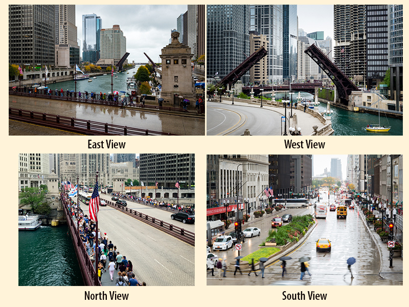
(Numbers below correspond to map locations - click on number to jump to description)
There are many opportunities for memorable photographs along the Chicago River as it flows through downtown. We (Pat & Jim) have taken hundreds of pictures of this stretch of river, most of which were not memorable.
Our goal for this page is not to provide a definitive “must shoot” list of locations. Rather we hope to provide the first time visitor a place to start the exploration. Always be on the lookout anywhere along the river. The Chicago River is an ever changing and fascinating subject.
One of the differences of photographing an urban river versus a rural river is the relative rapid change in the cityscape around the urban river. This can be the result of artificial lighting at night or longer term changes resulting from construction projects. In the example photos here we will attempt to note construction projects that have impacted or may impact the view.
Be forewarned that these bridge decks have a fair amount of vibration when vehicles (especially buses, trucks, L's) cross. This can be a bit unnerving as well as make it difficult to hold your camera steady as you shoot from the deck.
Not included in our list are some annual events that involve bridges or the river. These include dyeing of the river for St. Patrick's Day (Mar), Magnificent Mile Lights Festival Parade (Nov), Chicago Marathon (Oct), Shamrock Shuffle (Mar/Apr), and the Rock'n'Roll Half Marathon (Jul).
The area in front of Trump Tower between Michigan and Wabash avenues has been a reasonable choice for watching the river dyeing and the fireworks at the end of the Magnificent Mile Lights Festival Parade.
The river dyeing usually starts around 9 AM on the Saturday before St. Patrick's Day. It draws large crowds and we try to be in place an hour before show time. This location is good to watch the injection of the dye, but we generally move on to various locations between State & Michigan depending on the general activity and the movement of the dye. If you are interested in seeing the green river without the crowds, the color stays around for a few days. Early the following Sunday morning is worth a try. Here is a link to some example photos from this event.
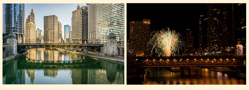
Wabash Ave. bridge the day after dyeing the river (L). Fireworks after the Magnificent Mile Lights Festival Parade (R).
We like this vantage point for viewing the fireworks from the Magnificent Mile Lights Festival Parade. It does not provide a close-up view of the parade, but it satisfied our goal to capture the Michigan Ave. bridge with the fireworks show.
The Chicago Marathon, Shamrock Shuffle, and Rock'n'Roll Half Marathon provide an opportunity to see large numbers of runners and spectators at some Loop Bridges. We have followed the Chicago Marathon as it crossed five bridges, four of wich are on the Main Stem (Columbus, State, LaSalle, & Franklin). The logistics of following these races along the Main Stem should be simplified by using the Riverwalk. Here is a link to some example photos from the 2011 Chicago Marathon.
One final comment about the Chicago River. The downtown area is easy to access and scenic, but the Chicago Water Taxi provides an easy and inexpensive way to explore sections of the North and South branches from the water. These side trips are well worth the time.
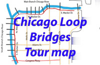
The descriptions below are keyed to the numbered markers on the map above.
The Chicago River as viewed from the Lake Shore Dr. bridge.
⨷ 1. Lake Shore Dr. bridge - The photograph above was taken from the west sidewalk on the lower deck of Lake Shore Dr. bridge (there is no pedestrian access to the upper deck). It provides a view of Chicago from the mouth of the river. This view will soon change as the Vista Tower ( 375 E. Wacker Dr. - under construction) takes shape on the south bank.
Views from the Bridgehouse Museum
⨷ 2. Bridgehouse Museum - The McCormick Bridgehouse & Chicago River Museum offers a bridge operator's 360° view from the top floor of the SW bridgehouse. Notice that to the east, you can see to the lake. Because of the bend in the river between Michigan and Wabash avenues, the west view is limited to a few blocks.
Views from the area around Wabash Ave. and State St.
⨷ 3. Wabash/State - The area around the State and Wabash bridges has multiple views. Looking west there are views to Wolf Point (Note, the photo showing western views from State St. predate the Wolf Point West and River Point Plaza towers currently in place). Looking to the east, views of some of the iconic towers in the area (Wrigley Bldg., Tribune Tower, & the John Hancock Center) are available. Another nice spot for photos in the area is the AMA Plaza at 330 N. Wabash on the north bank. Experiment with street level and Riverwalk views.
Views from the LaSalle and Wells St. area.
⨷ 4. LaSalle/Wells - Our favorite views from the La Salle St. bridge are those shown above. The view to the east was taken near the NE bridgehouse of the bridge. The view into the financial district taken from the median on the north side of the bridge captures some of the iconic features of Chicago (bridge, L, Board of Trade).
The east view from the Wells St. bridge provides an impressive view of the skyline along the river (taken mid-span on the bridge). Looking west from this bridge captures reflections from the newest towers (150 N. Riverside plaza, River Point Plaza, & Wolf Point West - left to right) at or near Wolf Point can be captured (taken from the NE corner of the bridge).
Views from area around Franklin St. bridge
⨷ 5. Franklin - We like the views to the east and southwest of the Franklin St. bridge best. The east views provide the skyline as well as an opportunity to capture the L crossing the Wells St. bridge (taken at the NE corner of the bridge). The southwest perspective produces views of the curved building at 333 W. Wacker Dr. and with the bridge down a glimpse of the Willis Tower (taken in front of the Merchandise Mart on the north bank).
Views from Wolf Point area
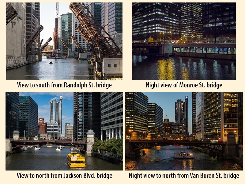
⨷ 6. Wolf Point Area - The four views here are a sampling of the views near Wolf Point. All views look south. Wolf Point can be accessed from Wolf Point Plaza. A stairway on the east side of the Wolf Point West apartment building leads to the public walkway at river level. This same walkway continues along the east bank of the North Branch to the bridges at Kinzie street.
New access to the west bank of the North Branch is provided by the public walkway in front of the River Point Plaza at the NW corner of Lake St. bridge.
Some views on the South Branch
⨷ 7-10. South Branch Buildings along the South Branch are closer to the water’s edge giving the area a "canyon" feel. There are many places on both sides of the river to take photos, but the view is not as expansive as those on the Main Stem.
Three of the views chosen are shots through the canyon (note that the two photos looking north pre-date the 150 N. Riverside Plaza, River Point Plaza, and Wolf Point West towers).
The view looking south documents a rare bridge lift with four bridges up at once. The timing of this lift was around the vernal equinox. During the vernal and autumnal equinoxes, the rising and setting sun lines up with the east-west streets, which in this case did a nice job of highlighting the raised bridge leaves.
The night view of the Monroe St. bridge includes a Metra train on Union Station tracks below street level. This photo was was taken from the east bank of the South Branch (from the outdoor dining/walkway area on the riverside of the Mercantile building at 30 S. Wacker Dr).

